

Altimeter GPS (Speedometer & Location Tracking)

คำอธิบายของAltimeter GPS (Speedometer & Location Tracking)
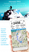
Get your elevation, climb rate and much more, wherever you are !
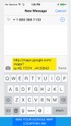
SMS your map location link
Your location link is very helpful in sometimes,such like when you are lost and you want ask your friends for a help. For this situation, you just need send your location link to she/he, and your friend can find you and your ways very easily in the building Maps (for map view in a web browser).
Features included
- Imperial and Metric unit settings.
- Altiude calibrate refresh button.
- GPS accuracy indicator.
- GPS distance accuracy indicator.
Track information
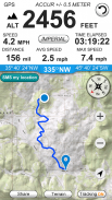
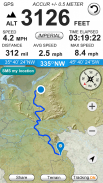
- Time elapsed.
- Distance.
- Average speed.
- Max speed.
- Altitude.
Tracking
- Speed tracking in mph or km/h based on MPH or KM/H mode.
- Distance tracking in miles or kilometers based on MPH or KM/H mode.
- Time tracking.
- Tracking location on map.
- Ability to turn tracking off/on.
- Longitude, latitude coordinates.
Map integration
- Satellite maps mode.
- Hybrid maps mode.
- Standard maps mode.
- Tracking location changes trajectory.
Compass
- Shows device real-time orientation to magnetic fields.
- Ability to switch between true and magnetic North.
- Location coordinates (longitude, latitude).
- Course
Share
- Start, end points, coordinates link email sending
ได้รับการยกระดับของอัตราการปีนและอื่น ๆ อีกมากมายทุกท่าน!
SMS เชื่อมโยงแผนที่สถานที่ตั้งของคุณ
การเชื่อมโยงสถานที่ของคุณจะมีประโยชน์มากในบางครั้งเช่นเมื่อคุณจะหายไปและคุณต้องการขอให้เพื่อนของคุณสำหรับความช่วยเหลือ สำหรับสถานการณ์นี้คุณเพียงแค่ต้องส่งลิงก์ตำแหน่งของคุณให้เขา / เธอและเพื่อนของคุณสามารถหาคุณและวิธีการของคุณได้อย่างง่ายดายมากในอาคาร Maps (สำหรับมุมมองแผนที่ในเว็บเบราเซอร์)
คุณสมบัติที่รวม
- การตั้งค่าหน่วยอิมพีเรียลและเมตริก
- ปุ่ม Altiude สอบเทียบการฟื้นฟู
- ตัวบ่งชี้ความแม่นยำของ GPS
- ตัวบ่งชี้ความถูกต้อง GPS ระยะ
ติดตามข้อมูล
- เวลาที่ผ่านไป
- ระยะทาง
- ความเร็วเฉลี่ย.
- ความเร็วสูงสุด.
- ระดับความสูง
การติดตาม
- ติดตามความเร็วในไมล์ต่อชั่วโมงหรือกิโลเมตร / ชั่วโมงขึ้นอยู่กับไมล์ต่อชั่วโมงหรือโหมด KM / H
- ติดตามระยะทางในไมล์หรือกิโลเมตรขึ้นอยู่กับไมล์ต่อชั่วโมงหรือ KM โหมด / H
- ติดตามเวลา
- สถานที่ตั้งการติดตามบนแผนที่
- ความสามารถในการติดตามเพื่อเปิด / ปิด
- ลองจิจูดพิกัดเส้นรุ้ง
บูรณาการแผนที่
- โหมดแผนที่ดาวเทียม
- โหมดไฮบริดแผนที่
- โหมดแผนที่มาตรฐาน
- สถานที่ตั้งการติดตามการเปลี่ยนแปลงวิถี
เข็มทิศ
- แสดงการวางแนวอุปกรณ์แบบ real-time เพื่อให้สนามแม่เหล็ก
- ความสามารถในการสลับไปมาระหว่างความจริงและแม่เหล็กนอร์ท
- พิกัดที่ตั้ง (เส้นแวง, ละติจูด)
- หลักสูตร
หุ้น
- จุดเริ่มต้นการสิ้นสุดพิกัดอีเมลการเชื่อมโยงการส่ง


